RIVERS App Training - Cross River
Join us to learn about TU's Community Science Tools
Sun, Aug 11, 2024 10:00 AM (EDT)
Ward Pound Ridge Reservation - Meadows Parking Lot,
Cross River,
New York
Questions?
Contact Event Host
Details
This event ended
Sun, Aug 11 - 02:00 PM
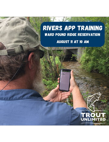
Join us on Sunday, August 11th for a training session on TU's RIVERS App on the Cross River at Ward Pound Ridge Reservation to help identify disturbances!
The RIVERS App is an easy to use photo documentation tool for volunteers to collect data and mark disturbances while out fishing or conducting a watershed inventory. Common disturbances include small dams, undersized culverts, areas of excessive erosion, clear cut banks, and more. Images of these disturbances are geotagged and added to a map which helps our chapter and TU Staff identify and prioritize future projects when funding opportunities arise.
During the training, we'll cover:
- Downloading and installing the RIVERS app (Survey123)
- Types of disturbances
- How to properly document disturbances using the app
We'll walk a section of the Cross River as a group before dividing up into smaller teams to survey other sections of the river. This will help us collect critical data to help improve habitat for wild and native trout on the Cross River.
Loading...
Loading...
No fundraising information was found.
Loading...
Loading...
No performances assigned to this
track.
{{ performance.title }}
{{ performance.startDateDisp }} -
{{ performance.endDateHH }} {{ performance.endDateMM }} {{ performance.endDateAMPM }}
{{ performance.description }}
{{ directions }}
Ward Pound Ridge Reservation - Meadows Parking Lot
NY-121
Cross River,
New York
10518